Exhibitions
The historical maps of Yugoslavia - permanent exhibition at the hall of the Archives building
The exhibition was organized in early March 2009 on the occasion of the February 19, 2009 Serbian government decision to restore the name The Archives of Yugoslavia to the institution. Visitors will be able to see the exhibits during the Belgrade Museum Night on May 16, 2009.
Organisation: Archives of Yugoslavia
Author of the exhibition: Mitar Todorović
Information provided in: prospectus
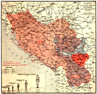
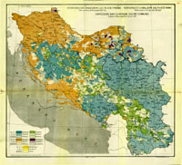
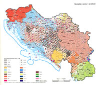
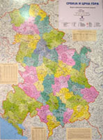
The exhibition The Historical Maps of Yugoslavia, encompasses 8 maps from the periods of the existence of the Yugoslav state from 1918-2006. The exhibition consists of maps of the administrative and occupation division of the Yugoslav state, the religious and ethnic belonging of its peoples. The maps are accompanied by legends containing data about its: area, population and religious and ethnic belonging. The selection of historical maps was done by Mitar Todorović, historian – archivist of the Archives of Yugoslavia. The exhibition was set up in the hall of the Archives in March 2009, when the former name of the Archives - The Archives of Yugoslavia - was returned, the name it held the longest and the name it is known for in scientific and general circles
1. THE MAP OF THE HISTORICAL DEVELOPMENT OF THE KINGDOM OF SERBS, CROATS AND SLOVENES 1804-1918.
 The ceremonious proclamation of the State Union of Serbs, Croats and Slovenes followed the decision of their representatives on unification. On 25th November 1918, the Great National Assembly in Novi Sad brought the Decision for Vojvodina to join the Kingdom of Serbia. The deputies of the Great National Assembly of the Serbian people in Montenegro decided on 26th November 1918 in Podgorica "for Montenegro to unite with fraternal Serbia into one single state."
The Board of the National Council of Slovenes, Croats and Serbs, pressed by the developments, brought the decision to unite with Serbia on 24th November 1918 in Zagreb. After certain deliberations, a delegation of the Council was sent to Belgrade to harmonize their views with the representatives of the Serbian Government concerning the provisional establishment of the unified state until the enactment of the Constitution.
Regent Aleksandar proclaimed on 1st December 1918 in Belgrade "the unification of Serbia with the countries of the independent state of Slovenes, Croats and Serbs into the united Kingdom of Serbs, Croats and Slovenes". The Regent proclaimed the unification of Serbia with “the countries of the independent state of Slovenes, Croats and Serbs,” and not with the state of Serbs, Croats and Slovenes, which was not internationally recognized.
The kingdoms of Serbia and Montenegro, Austria-Hungarian territories settled by the South Slavic peoples: parts of Banat, Bačka and Baranja, Srem, Slavonia and Croatia, parts of Koruška, Štajerska and Kranjska, Dalmatia and Bosnia and Herzegovina, as well as the Caribrod, Bosilegrad and Strumica districts, that were part of Bulgaria until the signing of the Treaty of Neuilly, all entered the Kingdom of Serbs, Croats and Slovenes.
2. THE KINGDOM OF SERBS, CROATS AND SLOVENES (ADMINISTRATIVE DIVISION INTO REGIONS)
 unitarianism, or centralism, originated from the national unitarianism, i.e. from the stand on national unity. According to that conception, "this nation of three tribes and three names" consisted of the three tribes of Serbs, Croats and Slovenes, composing nationally a single nation. This "tribal trinity" was expressed in the name of the state, its coat of arms, flag and official language. The Constitution prescribed the division of the state into regions consisting of a maximum of 800 000 resident inhabitants.
On October 27, 1921, King Aleksandar approved for the proposal of the Law on the Division of the Country into Regions to be presented before the National Assembly. Since the Croatian block within the Board of the Assembly opposed the proposal of the Law, the Government of Nikola Pašić brought the Decree on the Division of the Country into Regions on April 26 1922. The Kingdom of SCS was divided into 33 regions according to geographical, social, economic, but also ethnic and historical principles. Serbia was "fragmented" into 14 regions, Bosnia and Herzegovina into 6 regions "within its current borders", Croatia into 4, Vojvodina into 4, Macedonia into 3, Slovenia into 2, whilst Montenegro remained one whole region.
The implementation of the Charter, especially in Croatia, was delayed for several years and was the subject of political negotiations because the Croats opposed the "partitioning".
3. THE MAP OF THE KINGDOM OF YUGOSLAVIA
 The idea of national unitarianism was built into the Law on the Name and the Division of the Kingdom into Administrative Regions on October 3, 1929, which changed the name of the KSCS into The Kingdom of Yugoslavia, dividing it into nine banovinas. When forming these banovinas, in accordance with the ideology of an integrated Yugoslavia, the names of previous historical provinces were neglected and the entities were formed according to geographical and economic principles and the regions were named after the names of rivers.
Croatian aspirations were taken considerably into account when forming the banovinas, but also those of others. Serbs formed the majority in five banovinas. The division into banovinas was aimed at breaking up historical entities, but this was unavoidable in some cases. Slovenia found itself within the Drava Banovina, Macedonia within the Vardar Banovina, with parts of Serbia and Kosovo, Montenegro within the Zeta Banovina, with parts of Dalmatia, Metohija, Herzegovina, Bosnia and Sandžak. Croatia was divided into the Sava and Littoral Banovina, Vojvodina was within the Danube Banovina. Serbia was divided into the Morava, Drina, Danube, Zeta and Vardar Banovina, and Bosnia and Herzegovina into the Drina, Vrbas, Littoral and Zeta Banovina.
The borders of the banovinas were corrected on August 28, 1931. The Districts of Vukovar, Vinkovci and Županja were separated from the Drina Banovina, and Čabar from the Drava Banovina and affiliated to the Sava Banovina; Črnomelj was separated from the Sava Banovina and affiliated to the Drava Banovina; Stolac from the Zeta Banovina to the Littoral Banovina; Travnik from the Littoral Banovina and Ivanjica from the Zeta Banovina to the Drina Banovina; Djakovica and Orahovac from the Vardar Banovina and Srbica from the Morava Banovina to the Zeta Banovina.
The altering of the territorial organization occurred when the Cvetković-Maček Agreement was signed on August 26, 1939, when the Croatian Banovina was created, from the Sava and Littoral Banovina and the districts of Dubrovnik, Šid, Ilok, Brčko, Gradačac, Derventa, Fojnica and Travnik.
4. THE RELIGIONS IN THE KINGDOM OF SERBS, CROATS AND SLOVENES BY MUNICIPALITIES (ACCORDING TO THE CENSUS JANUARY 31, 1921)
 The 1921 census showed that in the Kingdom of SCS, spreading on an area of 247 542 km2, there were 11 984 911 inhabitants, of which 5 593 057 Orthodox Christians, 4 708 657 Roman Catholics, 1 345 271 Muslims, i.e. there were 5 341 675 Serbs, 2 816 454 Croats, 753 850 Muslims, 505 763 Germans, 467 412 Hungarians,
439 846 Albanians, etc.
5. THE DISTRIBUTION OF THE PEOPLES AND NATIONALITIES OF THE SFRY
 According to the 1981 census, the Socialist Federal Republic of Yugoslavia, on the area of 255 804 km2, had 22 424 711 inhabitants, of which 8 140 452 Serbs, 4 428 005 Croats, 1 999 957 Muslims, 1 753 554 Slovenes, 1 339 729 Macedonians, 579 023 Montenegrins, 1 730 364 Albanians, 426 866 Hungarians, 1 219 045 Yugoslavs, etc.
6. THE OCCUPATION DIVISION OF YUGOSLAVIA IN 1941
 After the April War in 1941, the occupying forces divided Yugoslavia. On May 15, 1941 Germany annexed Lower Štajerska and Gorenjska. Serbia was under German military administration and the entire military and civil administration was headed by the military commander. He appointed on May 3, 1941 the Commissioner for Civil Administration, and then, on August 29, 1941 the Government, headed by Army General Milan Nedić. There were separate German military and administrative-political administrations for the Banat and the Kosovska Mitrovica district.
Italy formed the Ljubljana Province from the annexed Slovenian territory on May 3, 1941. The Rijeka and Dalmatia provinces were formed on May 21, 1941 from the Croatian coast with the Kvarneri islands and part of the Dalmatian islands. In this way Italy governed a larger territory than promised by the London Treaty of 1915. Montenegro was under direct Italian administration headed by a Governor. Boka Kotorska with the hinterland was annexed to Italy. Albania, being the Italian protectorate, took over on July 22, 1941 a part of Western Macedonia, Kosovo and Metohija and part of the Montenegrin border area.
Bulgaria occupied a larger part of Macedonia with Ohrid and South-Eastern Serbia with Pirot and Vranje, where, on May 11, 1941, the Skopje, Bitola and Aegean districts were formed. Hungary, during the April War, occupied, and on December 27, 1941 annexed, Bačka, Baranja, Medjumurje and Prekomurje.
Only several days after Yugoslavia was attacked by Germany and the other Axis Powers, the Independent State of Croatia was declared in Zagreb on April 10, 1941. It encompassed Croatia, Slavonia, Srem, Bosnia and Herzegovina, as well as a part of Dalmatia not annexed by Italy, although still under direct Italian military administration.
7. YUGOSLAVIA
 Unlike the central organization of the Kingdom of Yugoslavia, socialist Yugoslavia was a federative state, accentuated also by its name. The Yugoslav federation consisted of six republics and two provinces. Serbia was formed as a complex federal unit. The peoples and national minorities of Vojvodina and Kosovo and Metohija decided in the summer of 1945 to join Serbia. On September 1, 1945 the Autonomous Province of Vojvodina and the Autonomous Kosovo-Metohija Region were established. Their establishment and order were regulated by special laws stressing that they compose "an integral part of Serbia". Prior to that, the Presidency of the AVNOJ (The Anti-Fascist Council of the Peoples’ Liberation of Yugoslavia) formed a Commission which implemented the separation of Vojvodina and Croatia on June 19, 1945. The President of the Commission, Milovan Djilas, noted that “autonomous Vojvodina presented the victory of the idea of Great Serbia”. It is worth mentioning that the borders of the republics were never actually legally established and marked. Essential changes of the structure of the federation were initiated by the Constitutional Amendments in 1967 and 1968, and the entities were completely formed in 1971 and by the Constitution of the Socialist Federal Republic of Yugoslavia of 1974. The Amendments limited and weakened the independence of the Federation and placed it under the supervision of the structures of the republics and provinces. The status of autonomous provinces was expanded and the "sovereign rights" started to be implemented in the provinces as well, as they attained the status of constitutional elements of the Federation, although they did not have the features of federal units as the republics had. The position and status of Serbia and the autonomous provinces within the federation were in essence made equal. The Amendments of December 26, 1968 changed the name of the Autonomous Province of Kosovo and Metohija into: the Socialist Autonomous Province of Kosovo.
8. THE STATE UNION OF SERBIA AND MONTENEGRO
 this was done by method of armed secession. In the case of Yugoslavia, the principle of territorial integrity and its internationally recognized borders were not respected. Contrary to international law, the borders of the republics, never legally established nor marked, became borders of sovereign states. The right of the peoples to self-determination was interpreted as the right to secession. The right to self-determination was linked to the federal units and they became beneficiaries of that right. Following the international recognition of Slovenia, Croatia and Bosnia and Herzegovina, Serbia and Montenegro decided to continue their existence as a common state. The Federal Council of the Assembly of the SFRY adopted on April 27, 1992 the Constitution of the Federal Republic of Yugoslavia. The state was defined as a sovereign federal state based on the equality of its citizens and the equality of its member republics. Based on the essential principles of reestablishing the relationship of Serbia and Montenegro signed on March 14, 2002 in Belgrade, the Federal Assembly proclaimed the Constitutional Charter of the State Union of Serbia and Montenegro on February 4, 2003. The Constitutional Charter stressed that "upon expiry of a three-year period the member states have the right to initiate procedures for altering the state status, i.e. to withdraw from the State Union of Serbia and Montenegro". On May 21, 2006, Montenegro organized a referendum and became an independent state.


